Imray
Imray M17 North Tuscan Islands-Rome
€ 35,50
Imray M17 North Tuscan Islands-Rome
Online
Direct leverbaar
In de winkel
Op voorraad
Kom langs in de winkel
Beschrijving
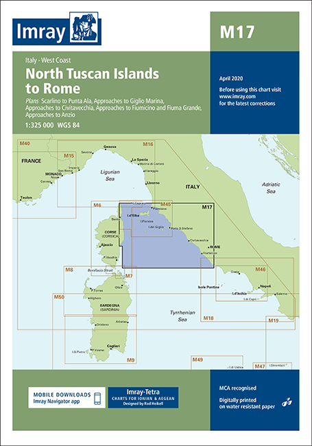
M17 North Tuscan Islands to Rome
Gegarandeerd de laatste editie.De M zeekaarten van Imray zijn overzichtskaarten en detailkaarten van de gehele Middellandse Zee:
Op de cover / afbeedling van de betreffende kaart vindt u de editiedatum, de schaal en staan de diverse gedetailleerde havenaanlopen vermeld.
Chart scale 1:325 000
Plans included:
Scarlino to Punta Ala (1:85 000)
Approaches to Giglio Marina (1:10 000)
Approaches to Civitavecchia (1:40 000)
Approaches to Fiumicino and Fiuma Grande (1:50 000)
Approaches to Anzio (1:50 000)
On this edition the latest known depths have been applied. Harbour developments at Civitavecchia and Fiumicino are included as is the restricted area on the approach to Anzio. The Corsican Channel TSS is shown, as are the extents of Marine Protected Areas on this chart. The chart specification has been improved to show coloured light flashes. There has been general updating throughout.
Deze zeekaarten zijn gevouwen tot A4 formaat en de totale afmeting is 640x900mm.
Tot er een nieuwe editie wordt uitgegeven kunt u correcties downloaden via de volgende link:
https://www.imray.com/corrections/
Specificaties
| testdave3 | € 0,00 |
|---|---|
| Landen Europa | Italië |
| Merk | Imray |
| Bol NL Volumekorting | Nee |
| Artikelnummer | 16M17 |
| Artikelstatus | Leverbaar |
| Topseller | Nee |
| Highlight | Nee |
| Bol NL Prijs | 0,00 |
| Serie | Imray M |
| Vaargebied | Middellandse Zee |
| Taal | English |
Gratis én snelle verzending
Bij bestellingen boven de €50
Shop de wereld van watersport
Groot assortiment met meer dan 20.000 artikelen
Gemakkelijk retourneren
Online makkelijk geregeld
De winkel van Vrolijk Watersport


Stap binnen in de winkel van Vrolijk Watersport
Wij zijn dé watersportwinkel van Scheveningen, gelegen in het havengebied.
Onze ruim opgezette winkel heeft een compleet assortiment voor zeil- en motorboten. Ook voor uw persoonlijke uitrusting is er veel keus. Merken als Musto, Helly Hansen, Gill, Secumar, Spinlock, Harken, Cobb, Omnia, Wichard, de IJssel, Plastimo, Talamex, Imray, NV Charts, ANWB en Nebo zijn het hele jaar op voorraad.

