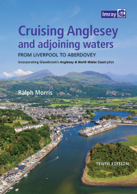
Cruising Anglesey and Adjoining Waters
Kom langs in de winkel
Beschrijving
Cruising Anglesey and Adjoining Waters
From Liverpool to Aberdovey
Ralph Morris's vaargids voor het eiland Anglesey en de Noord-Wales kust werd voor het eerst gepubliceerd meer dan 30 jaar geleden. In die tijd dekte het weinig meer dan het eiland zelf. In de loop der jaren is deze pilot uitgebreid tot het nu de informatie biedt over getijden, gevaren, havens en ankerplaatsen en havenplannen van Liverpool (jachthaven) naar Aberdovey (dezelfde wateren die worden gedekt door het 2700 kaartpakket van Imray). Correcties worden uitgegeven zodra ze zijn ontvangen en zijn toegankelijk via de onderstaande link. Deze volledig bijgewerkte negende editie werd gepubliceerd in juli 2016 en wordt gepresenteerd in hetzelfde formaat als zijn voorgangers - spiraalgebonden voor eenvoudig gebruik in de kuip, kleur, afbeeldingen, luchtfoto's (met dank aan Google Earth) en bijna 100 originele foto's. Ralph Morris leerde de weg op Anglesey - in een kleine boot met een enkele kaart en een kompas dat op een dag koos om te falen in de mist. Dat is echter niet het enige dat aanleiding gaf tot de beslissing om deze pilot te schrijven. De belangrijkste drijfveer was de toenemende schaarste aan Henry Glazebrooks 'Anglesey & North Wales Coast Pilot', die hem uit vele krappe bochten heeft gehaald. Het detail en de precisie van de piloot van Glazebrook is legendarisch en met deze gids hoopt de auteur de toegankelijkheid van deze wateren te behouden.
This fully updated, tenth edition is spiral-bound for easy cockpit use, full colour, chart graphics, aerial views (courtesy of Google Earth) and nearly 100 original photos. It also makes reference to the most noteworthy event in recent years- the wholesale destruction of Holyhead Marina by Storm Emma in March 2018.
Ralph Morris learned his way around Anglesey the hard way - in a day boat with a single chart and a compass which one day chose to fail in fog. That's not the only thing which prompted the decision to write this pilot, though- the prime mover was the increasing scarcity of Henry Glazebrook's ‘Anglesey & North Wales Coast Pilot’, which got him out of many tight corners. The detail and precision of Glazebrook’s "Anglesey & North Wales Coast Pilot" is legendary and, through this guide, the author hopes to maintain its accessibility to all yachties sailing these waters.
Kenmerken:
- Artikelnummer: IB0196-1
- Schrijver: Ralph Morris
- Uitgever: Imray
- 10de Editie
- Uitgifte datum 2021
- Publicatie details: A4. Soft cover spiral binding. Full Colour
- Engelstalig
- ISBN 9781786791825
Specificaties
| Landen Europa | Verenigd Koninkrijk |
|---|---|
| Merk | Imray |
| Bol NL Volumekorting | Nee |
| Bol NL Prijs | 50,95 |
| EAN | 9781846237652 |
| Artikelnummer | 15547 |
| Artikelstatus | Leverbaar |
| Topseller | Nee |
| Highlight | Nee |
| Marketplaces | Bol.com NL |
| Vaargebied | Ierse Zee |
| Taal | English |
De winkel van Vrolijk Watersport


Stap binnen in de winkel van Vrolijk Watersport
Wij zijn dé watersportwinkel van Scheveningen, gelegen in het havengebied.
Onze ruim opgezette winkel heeft een compleet assortiment voor zeil- en motorboten. Ook voor uw persoonlijke uitrusting is er veel keus. Merken als Musto, Helly Hansen, Gill, Secumar, Spinlock, Harken, Cobb, Omnia, Wichard, de IJssel, Plastimo, Talamex, Imray, NV Charts, ANWB en Nebo zijn het hele jaar op voorraad.

