


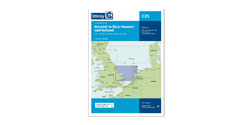


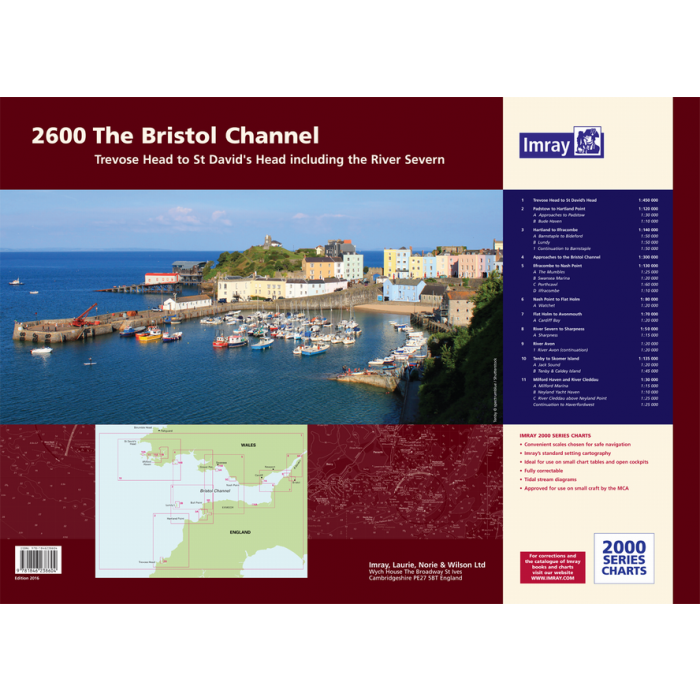
Imray 2600 Bristol Channel
2600 Bristol Channel Chart Pack
Trevose Head to St David’s Head including the River Severn
Gegarandeerd de laaste editie en zonder verzendkostenDe 2000 serie zeekaarten van Imray zijn overzichtskaarten en detailkaarten op A2 formaat van verschillende populaire kustwateren van:
1. Nederlandse kust en de Waddenzee
2. De kustwateren van de Westzijde van Groot Brittanie.
3. Het Kanaal, zowel de Engelse als de Franse kust
4. De Thamesmonding en de Oostkust van Engeland
Op de cover / afbeedling van de betreffende kaartenset vindt u de editiedatum, de schaal en staan de diverse gedetailleerde havenaanlopen vermeld.
Ook staan daar alle kaarten die tot deze set behoren, met vermelding van de schaal.
Deze waterkaarten zijn ongevouwen tot A2 formaat en de afmeting is 590x420mm.
Tot er een nieuwe editie wordt uitgegeven kunt u correcties downloaden via de volgende link:
https://www.imray.com/corrections/
For this edition the latest depth surveys have been applied. The chart specification has been improved to show coloured light flashes. There has been general updating throughout.
The atlas contains 12 sheets-
2600.1 Trevose Head to St David’s Head 1:450, 000 WGS 84
2600.2 Padstow to Hartland Point 1:120, 000 WGS 84
Plans Approaches to Padstow, Bude Haven
2600.3 Hartland to Ilfracombe 1:140, 000 WGS 84
Plans Barnstaple to Bideford, Lundy, Continuation to Barnstaple
2600.4 Approaches to the Bristol Channel 1:130, 000 WGS 84
2600.5 Ilfracombe to Nash Point 1:130, 000 WGS 84
Plans The Mumbles, Swansea Marina, Porthcawl, Ilfracombe
2600.6 Nash Point to Flat Holm 1:80, 000 WGS 84
Plans Watchet
2600.7 Flat Holm to Avonmouth 1:70, 000 WGS 84
Plans Cardiff Bay
2600.8 River Severn to Sharpness 1:50, 000 WGS 84
Plans Sharpness
2600.9 River Avon 1: 20, 000 WGS 84
Plans River Avon (continuation)
2600.10 Tenby to Skomer Island 1:135 000 WGS 84
Plans Jack Sound, Tenby & Caldey Island
2600.11 Milford Haven - St Ann’s Head to Neyland Point 1:30, 000 WGS 84
Plans Milford Marina
2600.12 River Cleddau - above Neyland Point 1:25, 000 WGS 84
Plans Neyland Yacht Haven, Continuation to Haverfordwest
Imray Digital Charts: Free mobile download
A voucher code to download the relevant Imray digital charts into our Imray Navigator app is included with this atlas.
| Landen Europa | Verenigd Koninkrijk |
|---|---|
| Artikelnummer | 162600 |
| Externe_Barcode | 9781846238604 |
| testdave5 | 0,00 |
| Serie | Imray Sets |
| Vaargebied | Ierse Zee |
| Taal | English |
Advies nodig?
Verzenden
- Boven de € 50,- gratis verzonden.
- Imray uitgaven worden altijd gratis verzonden.
- Voor 16:00 op werkdagen besteld de volgende dag in huis.