


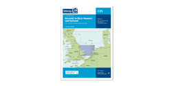


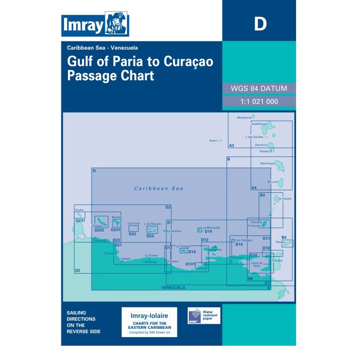
Imray D Venezuela Gulf Paria to Curaçao
Artikelnummer
16D
1-2 werkdagen levertijd
€ 35,50
Imray D Venezuela Gulf Paria to Curaçao
D Venezuela
Golfo de Paria to Curaçao Passage Chart
Gegarandeerd de laatste editie en geen verzendkosten.De A, B en D zeekaarten van Imray zijn overzichtskaarten en detailkaarten van het Caribisch gebied:
A - Puerto Rico, Virgin Islands en Leeward Islands
B - Windward Islands
D - Venezuela
Op de cover / afbeeldling van de betreffende kaart vindt u de editiedatum, de schaal en staan de diverse gedetailleerde havenaanlopen vermeld.
Imray-Iolaire charts for Caribbean are widely acknowledged as the best available for the cruising sailor. They combine the latest official survey data with first-hand information gathered over 60 years of research by Don Street Jr and his wide network of contributors. Like all Imray charts, they are printed on water resistant Pretex paper for durability, and they include many anchorages, facilities and inlets not included on official charts.
Deze zeekaarten zijn gevouwen tot A4 formaat en de totale afmeting is 640x900mm.
Tot er een nieuwe editie wordt uitgegeven kunt u correcties downloaden via de volgende link:
https://www.imray.com/corrections/
| Landen Noord-Amerika | Barbados, Bonaire, Curaçao, Grenada, Martinique, Saint Lucia, Saint Vincent en de Grenadines, Trinidad en Tobago |
|---|---|
| Artikelnummer | 16D |
| Landen Caribisch Gebied | Barbados, Bonaire, Curaçao, Grenada, Martinique, Saint Lucia, Saint Vincent en de Grenadines, Trinidad en Tobago |
| testdave5 | 0,00 |
| Serie | Imray D |
| Vaargebied | Caribisch Gebied |
| Taal | English |
Advies nodig?
Verzenden
- Boven de € 50,- gratis verzonden.
- Imray uitgaven worden altijd gratis verzonden.
- Voor 16:00 op werkdagen besteld de volgende dag in huis.
Viewed by others